405.9 miles: Willow Creek Loop via Gore Range Trail, Eagles Nest Wilderness, White River National Forest, Silverthorne, CO

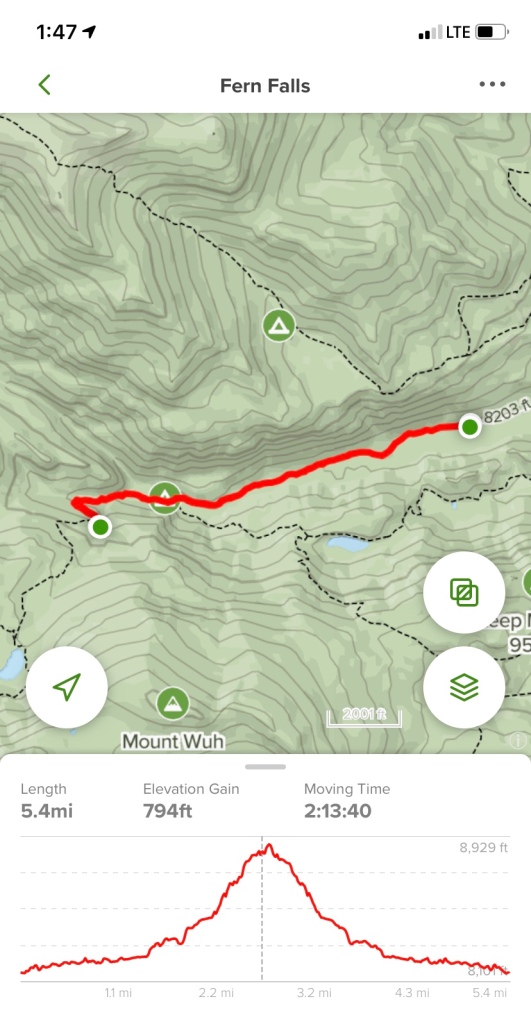
Date: September 27, 2020

Miles: 4.8 miles

Elevation Gain: 837 feet

Difficulty: Easy to Moderate

Time: 2hr total

Trail Head:

https://www.alltrails.com/trail/us/colorado/willow-creek-loop-via-the-gore-range-trail

Notes:

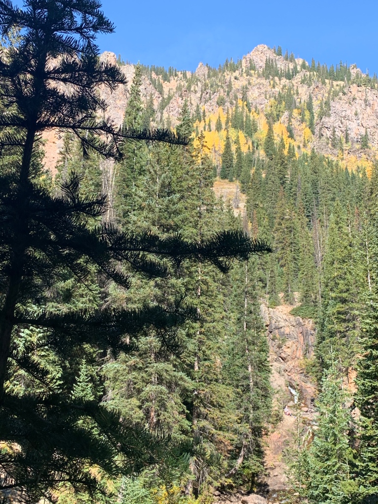
We finished out our fall weekend with another hike in the White River National Forest. This trail looks like a simple loop on the map, but there are a ton of unmarked trail junctions. Be sure to pay attention and make sure that you are following the correct trail. The parking lot is located in a residential neighborhood and is limited to only a few spots. We got to the trailhead early Sunday morning and snagged the last parking spot.

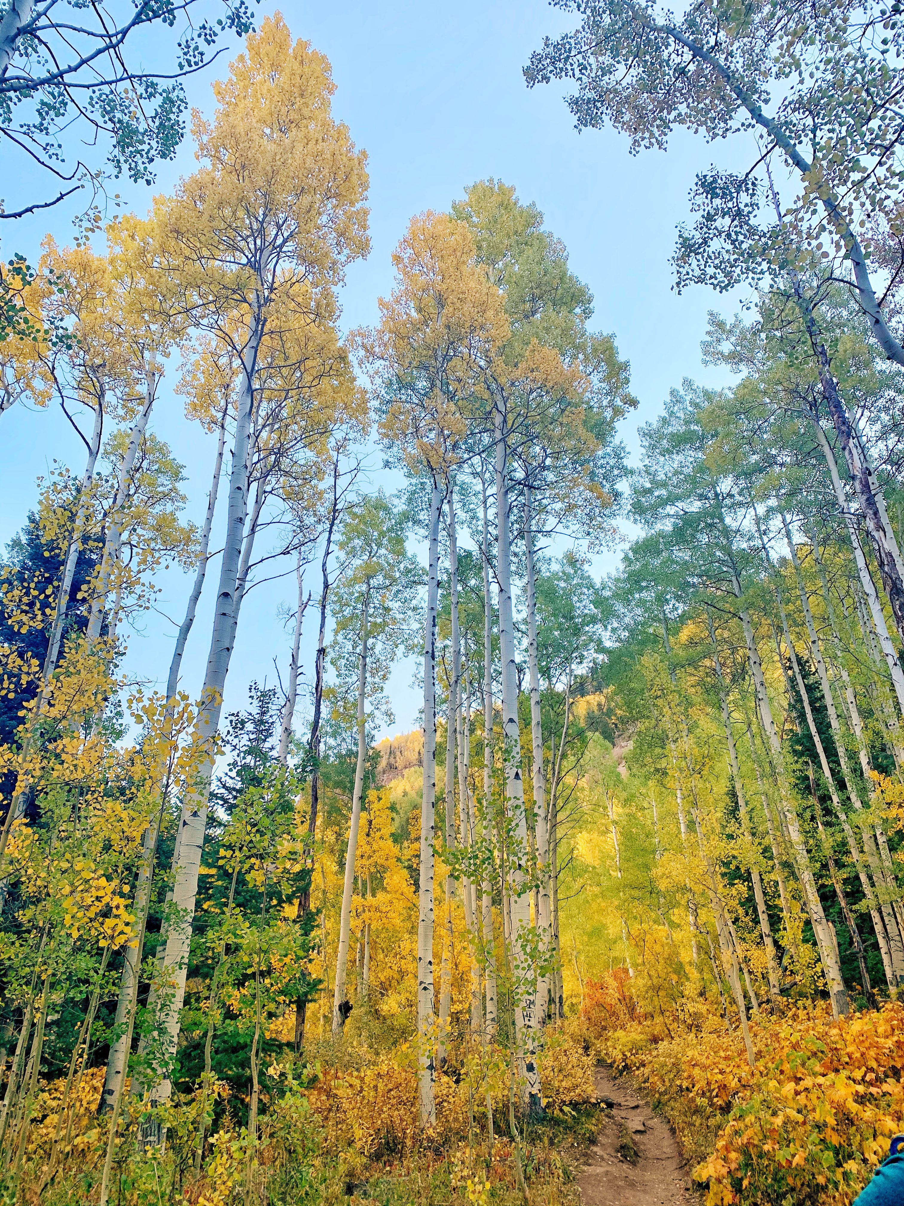
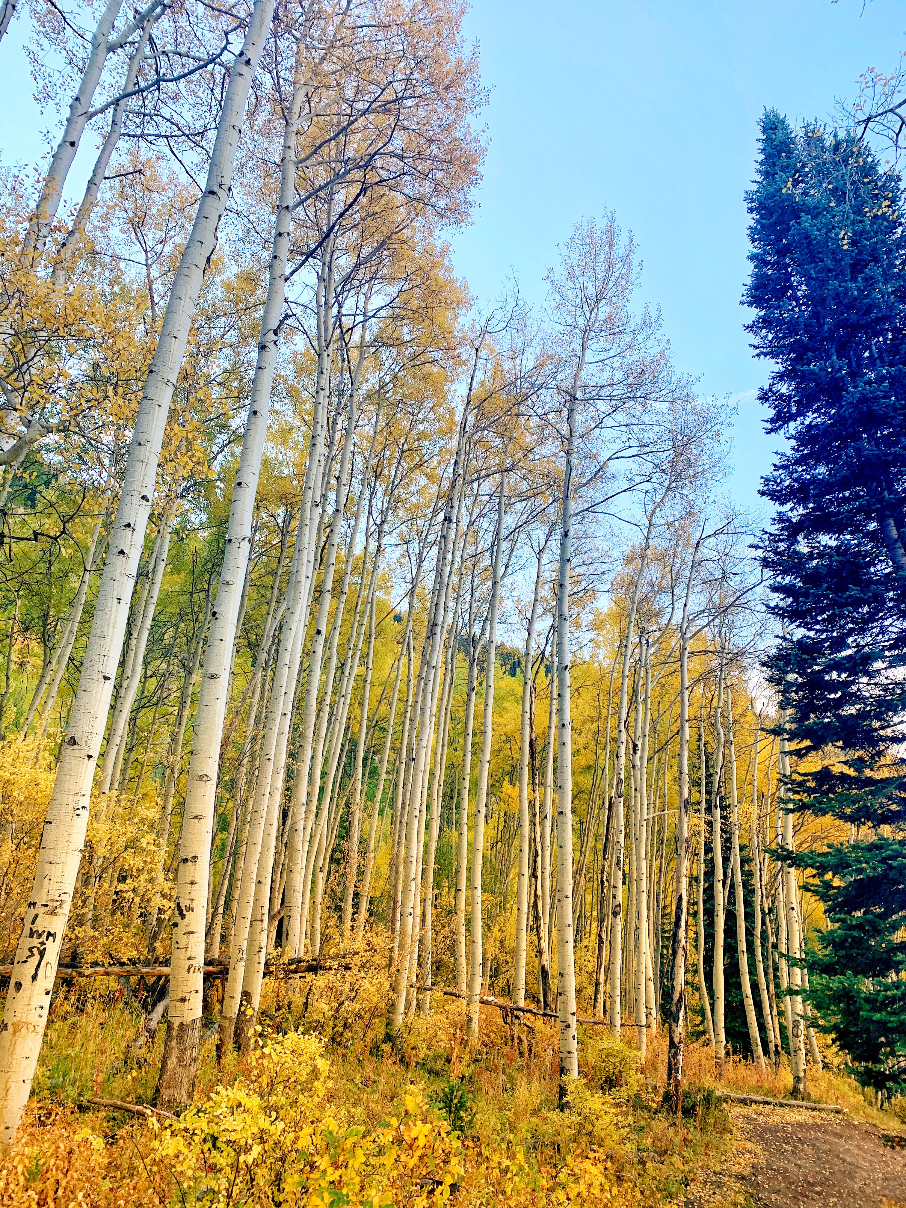
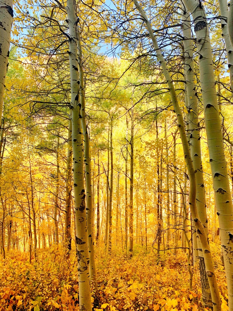
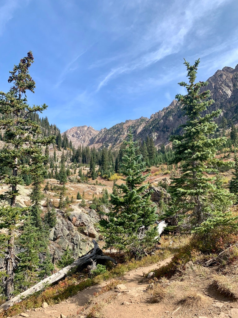
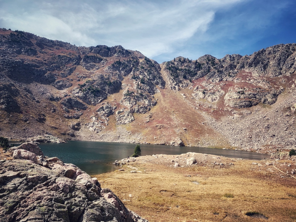
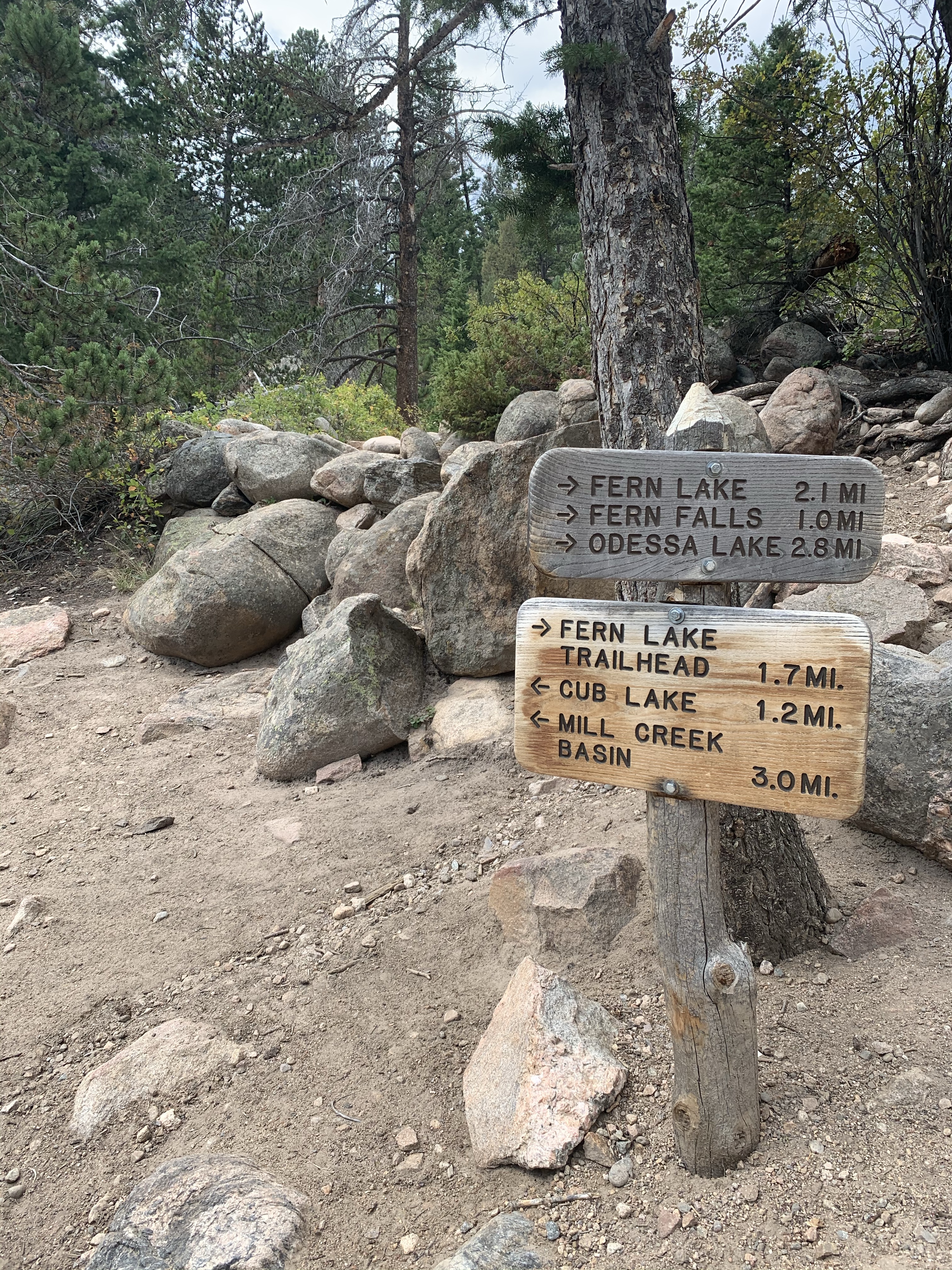
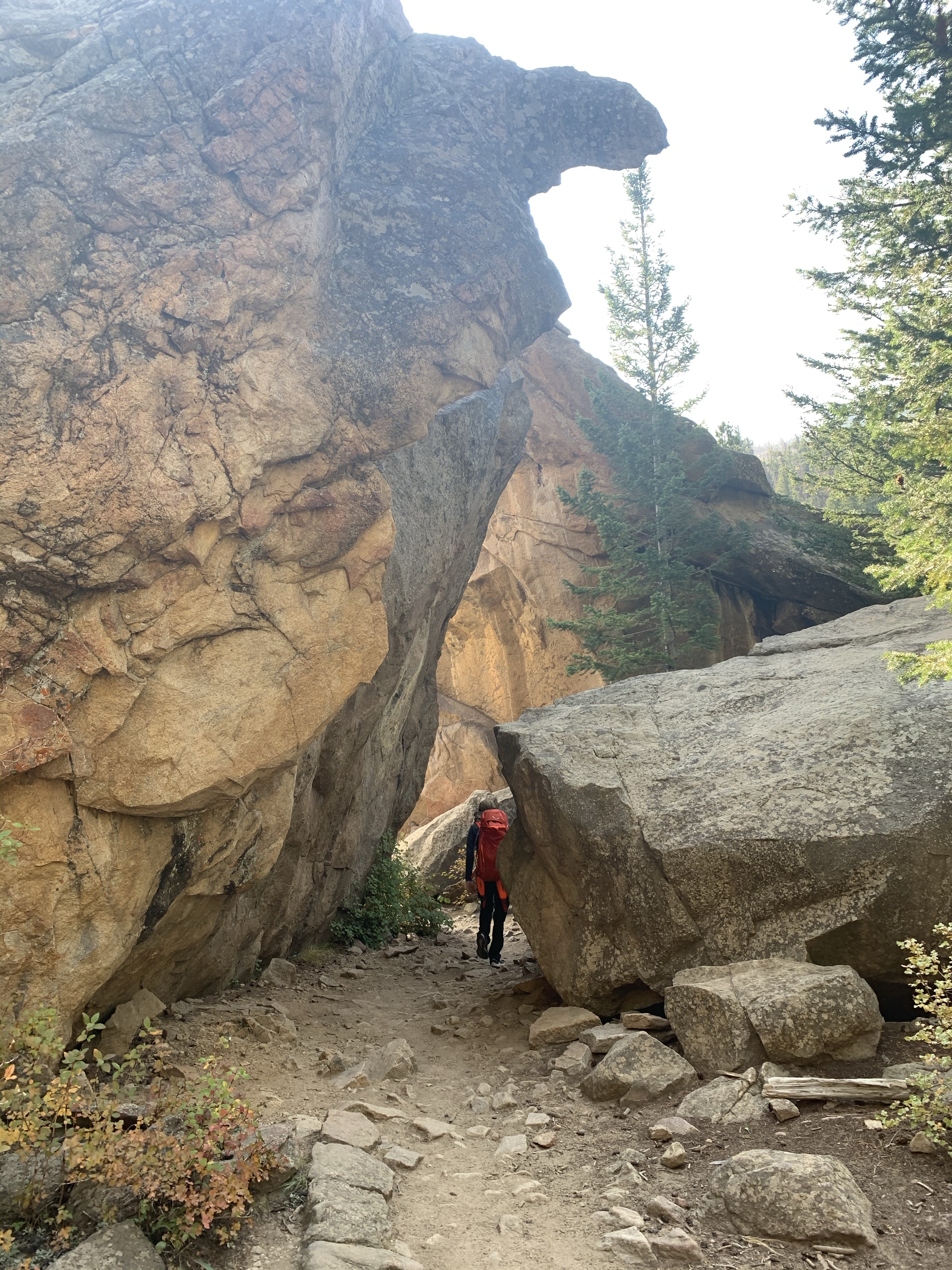
We chose to do the loop counter clockwise, for more of a challenge. For a more gradual incline, I would recommend completing the hike clockwise. Starting off, we followed South Willowbrook Trail to the right, climbing uphill through aspens. The first quarter of a mile the trail snakes through peoples backyards, but it gets quiet after that. We hit the first trail intersection about a half mile in and followed North Willow Creek trail to the left. From here, the trail begins to gain elevation quickly, and you chug uphill until about 1.4 miles, where things level out. Right before the elevation levels out, you reach the trail junction with Gore Range Trail, where you make a left (right goes to Willow Lake).

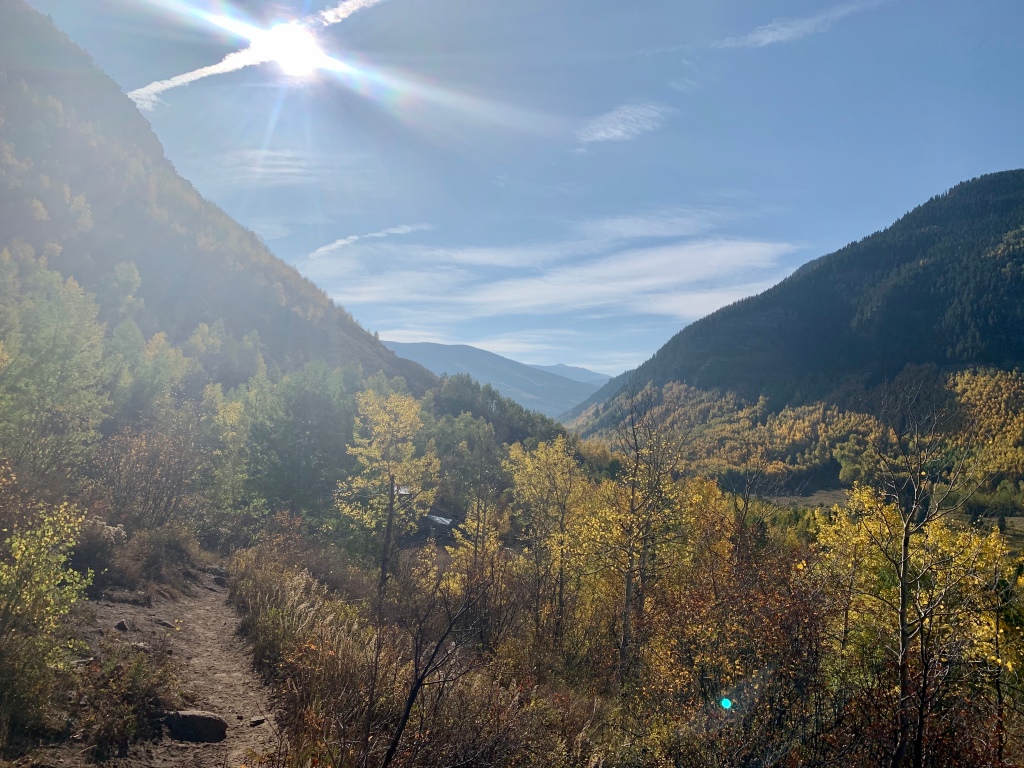
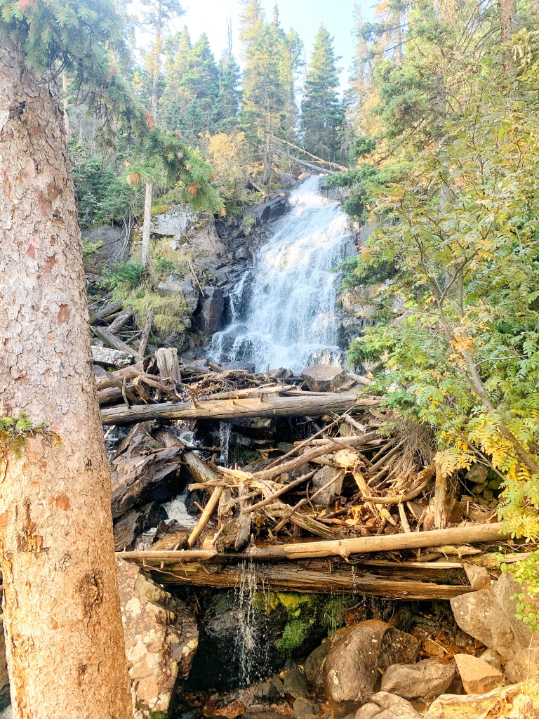
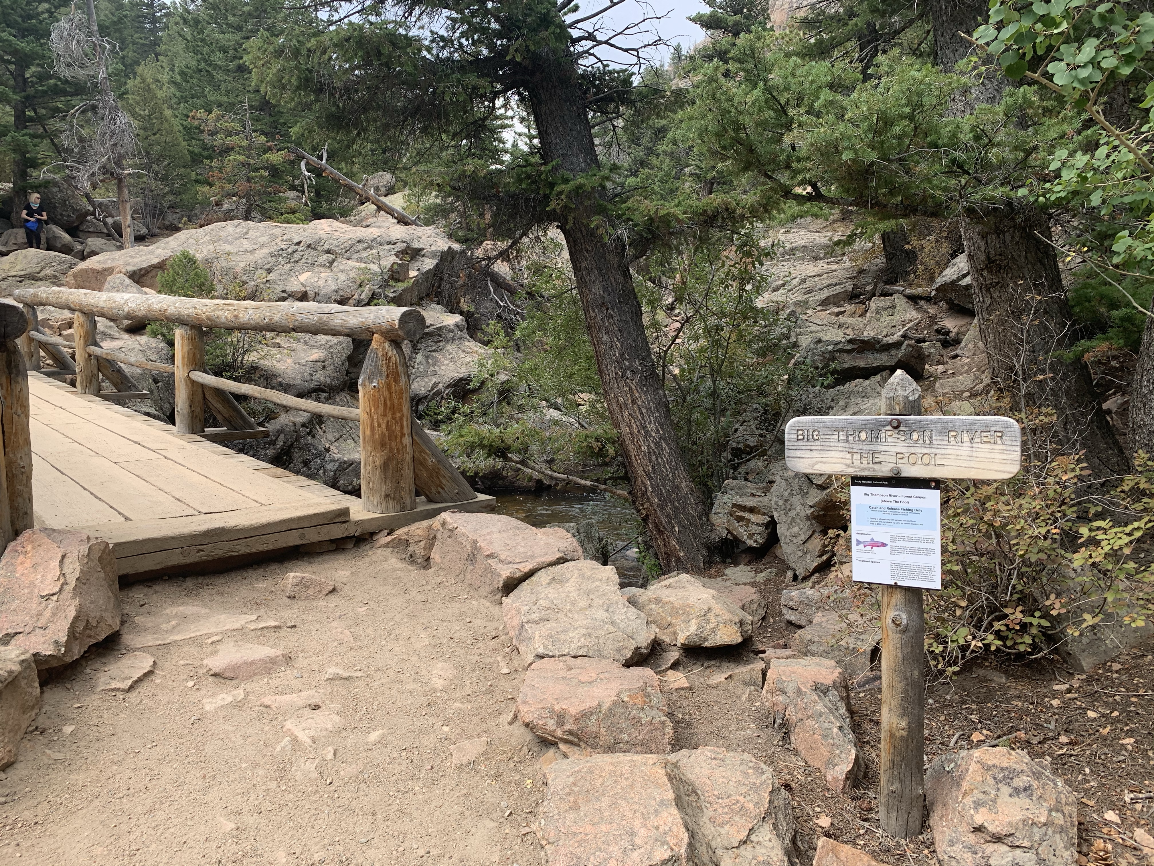
Gore Range Trail had great views of the Gore range and canyon below. You can also see the Dillon Reservoir from this section, which was pretty. Once you descend the majority of elevation, you reach Mesa Cortina Trail. Follow this to the right back to South Willowbrook Trail to complete the loop. Great falls colors! Next time when we have more time we will head to willow lake.

Left towards North Willow Creek Trail
Left to stay on North Willow Creek
Left to follow Gore Range Trail
Follow Mesa Cortina Trail
Follow South Willowbrook Trail

401.1 miles: Windsor Lake & Hangerman Tunnel, Mount Massive Wilderness, San Isabel National Forest, Leadville, CO

Date: September 26, 2020

Miles: 5.6 miles

Elevation Gain: 1362 feet

Difficulty: Moderate

Time: 3 hr total

Trail Head:

https://www.alltrails.com/trail/us/colorado/windsor-lake

Notes:

We continued our fall weekend hikes in the San Isabel National Forest, outside of Leadville. This trailhead is near the Turquoise Lake recreation area— I would highly recommend taking a weekend trip out here if you live in the Denver area. The Windsor Lake trailhead is down a dirt road, which closes for winter conditions. It was currently open and passable in a 2WD car. From Windsor Lake, there is a connecting trail you can take to add on Hangerman Tunnel, which we did for some added mileage. At 8 AM on a Saturday, there were few cars in the parking lot and no other hikers on the trail.

The hike to Windsor Lake is best described as short and steep. It’s about 1.2 miles to the base of the lake, just shy of 1000 ft gain. The trail immediately begins the elevation climb, following a creek through the pine forest. At .3 miles, you reach the trail junction with Hangerman Tunnel— go left to see the lake first. Once to the lake, the trail flattens out and goes the perimeter of the lake. We followed it about halfway around, then lost the trail so we headed back the same direction. Windsor Lake did not have any snow and we had the lake to ourselves the whole time we were there!

After heading down from the lake, we followed the trail junction to the left to see Hangerman Tunnel. The trail passed through a few other unmarked trails on this section— just keep making lefts. About a .5 mile from the trail junction is Douglas City— an abandoned mining town. The city has several remains of cabins, mining equipments and other turn of century debris. After Douglas City, you get to Hangerman Lake. From here, the trail climbs steeping towards an old train track— once to the junction of where the tracks would be, make a sharp left and the tunnel is a few hundred yards away. The Tunnel is a little scrabbly and sketchy to get to and is filled with ice. Use caution.

Fresh sign looking good
Trail junction .3 miles in— left goes to Windsor Lake, right goes to Hangerman Tunnel
We went left to the lake first
Short but steep
Little cave
Windsor Lake runoff
Windsor Lake to ourselves
Windsor Lake
Back to the trail junction and took the Hangerman Tunnel trail uphill
Remains of Douglas City, an old mining town. Used to have 20+ bars and a dance hall
Maybe the dance hall?
Hangerman Lake— lots of old mining equipment here
Views of Mount Massive in the distance
Entrance to Hangerman Tunnel
Ice inside Hangerman Tunnel

395.5 miles: Booth Lake, Eagles Nest Wilderness, White River National Forest, Vail, CO

Date: September 25, 2020

Miles: 9.6 miles

Elevation Gain: 3041 feet

Difficulty: Moderate to Difficult

Time: 5 hr 30 min total

Trail Head:

https://www.alltrails.com/trail/us/colorado/booth-lake–2

Notes:

We peep’d some leaves this weekend! I love when the aspens change gold in the mountains. This year, the window is supposed to be pretty short, so we spent the weekend hiking around fall colors. Our first trek was to Booth Lake, in Vail. Most people just hike the ~4.5 mile trail to Booth Falls, but we were feeling ambitious and wanted to cross off this alpine lake. It was definitely way more scenic than the falls— plus, a great gradual climb.

The trailhead parking lot is extremely limited, but it’s close to a free bus stop with a shuttle that stops throughout the Vail area. The beginning of the trail was pretty wide from frequent use and immediately begins to climb elevation. Here we hiked through golden aspens and willows, passing over a small creek a few times before reaching the “falls”. I’m sure in the spring time the falls are more exciting, but this time of year it was a little underwhelming. Once at the falls, the trail climbs from the base of the creek with a few steep eroded switchbacks. The trail then gains elevation more gradually, following the creek.

Around 3.5 miles we reached the subalpine tundra, with beautiful views behind us of Vail, Holy Cross and the canyon below. The last stretch to the lake was a little rocky, but the view of the Gore Range was worth it. Booth Lake was beautiful! It was really big for an alpine lake. We had the lake to ourselves for a stretch of time. No wildlife, but lots of goat fur. Despite the elevation gain being over 3K, the trail felt great since it was so spread out!

Booth “falls”
Booth Lake
Booth Lake

385.9 miles: Enchanted Forest and Apex Loop, Apex Open Space Park, Golden, CO

Date: September 23, 2020

Miles: 3 miles

Elevation Gain: 676 feet

Difficulty: Easy to Moderate

Time: 1 hr 30 min total

Trail Head:

https://www.alltrails.com/trail/us/colorado/apex-enchanted-forest-trail-loop

Notes:

It’s been awhile since I went for a weekday hike after work! It was nice to get out mid week and stretch my legs for an easy local hike. I met up with a friend at Apex Open Space for a social distance hike— the trailhead is along Lookout Mountain Road and does not have a formal parking lot at this trailhead. However, there was plenty of parking on the side of the road near the trailhead.

Although this trail was in a neighborhood, it feels more secluded since it’s in the canyon. The trail starts by descending curvy switchbacks (definitely built with a biker in mind) to the trail loop junction. We chose to first go right and follow the Enchanted Forest Trail. This trail continues to descend to the base of the canyon, through trees and over streams. About 1.7 miles in, we came to the next trail junction, where we followed Rocker trail to Apex trail. Once at Apex, we made a left to finish the short loop and ascend back up the canyon. There were a lot of bikers! We also heard elk bugling.

382.9 miles: Fern Creek Falls, Rocky Mountain National Park, Estes Park, Colorado

Date: September 20, 2020

Miles: 5.4 miles

Elevation Gain: 794 feet

Difficulty: Moderate

Time: 2 hr 30 min total

Trail Head:

https://www.alltrails.com/trail/us/colorado/fern-lake-trail

Notes:

For Sunday, we also decided to stick to a quieter trailhead, and started at Fern Lake summer trailhead. We followed the trail along the river (1.7 miles) to Big Pool, where we went right at the trail junction towards Fern Falls and Fern Lake. From the trail junction, Fern Falls is another mile. This next section contains the altitude gain, although it is spread out moderately. The trail winds through the pines, without too many look outs. We barely saw anyone on the hike to the falls. At the falls, we sat and had a quick snack before heading back to the car. Despite the recent snow in the mountains, this trail was dry. If you want to avoid the crowds at RMNP, I would definitely recommend this hike!