377.6 miles: Cub Lake Loop, Rocky Mountain National Park, Estes Park, Colorado

Date: September 19, 2020
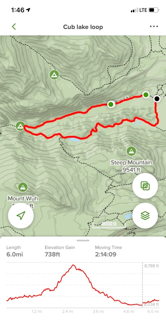
Miles: 6 miles

Elevation Gain: 738 feet

Difficulty: Moderate

Time: 2 hr 30 min total

Trail Head:

https://www.alltrails.com/trail/us/colorado/fern-lake-trail-and-cub-lake-trail-loop

Notes:

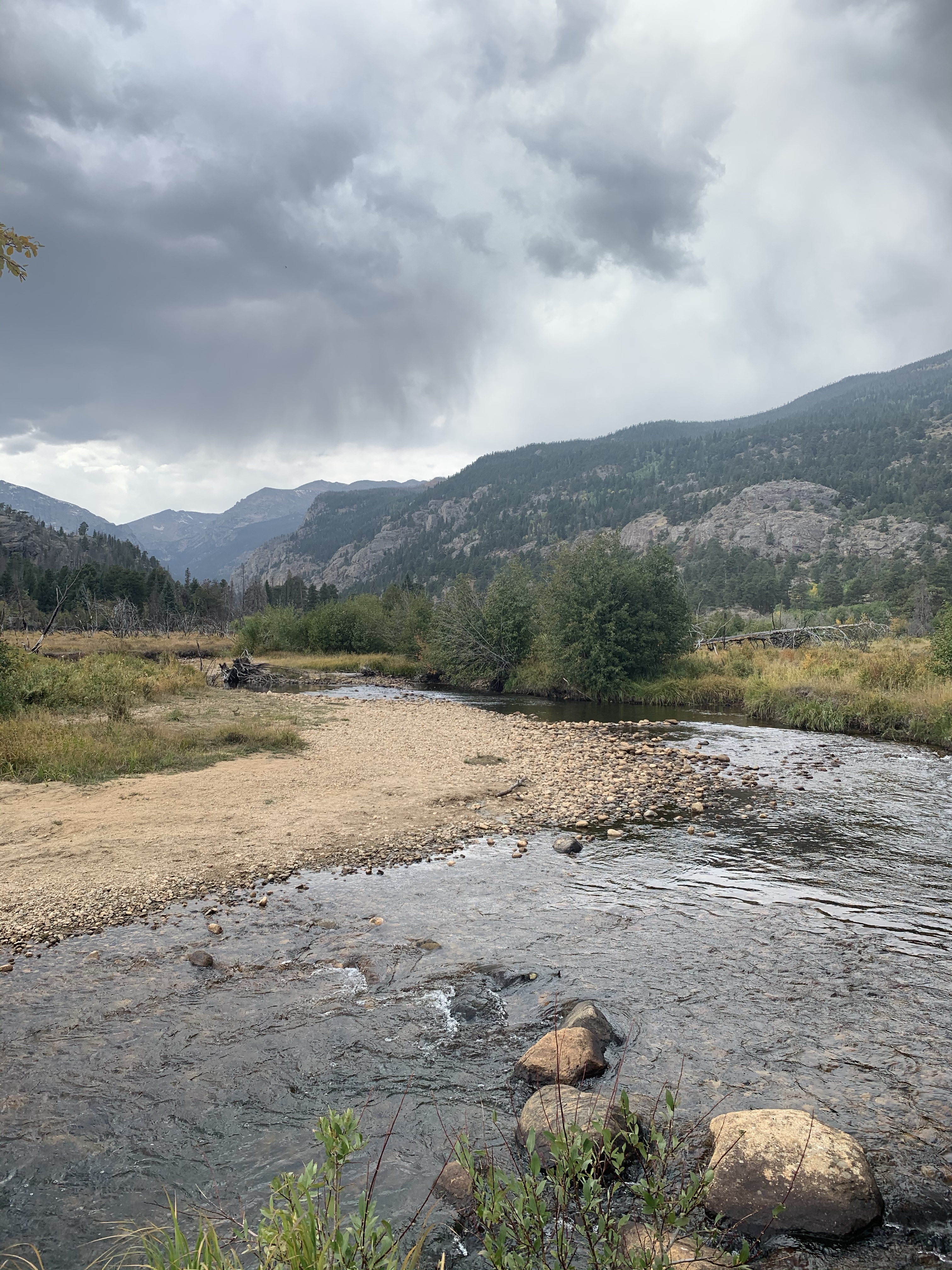
Travis and I got timed entry to Rocky Mountain National Park for our first wedding anniversary this past weekend! We got the tickets end of August and it already had limited times available for fall weekends— the mountains are super popular this time of year with the aspens changing gold. Our entrance time was 12 PM, so we opt for a less popular trailhead, Fern Lake. On the drive through Moraine Park, we past a few crowds of cars stopped to take photos of the elk rut— this time of year the meadows are closed.

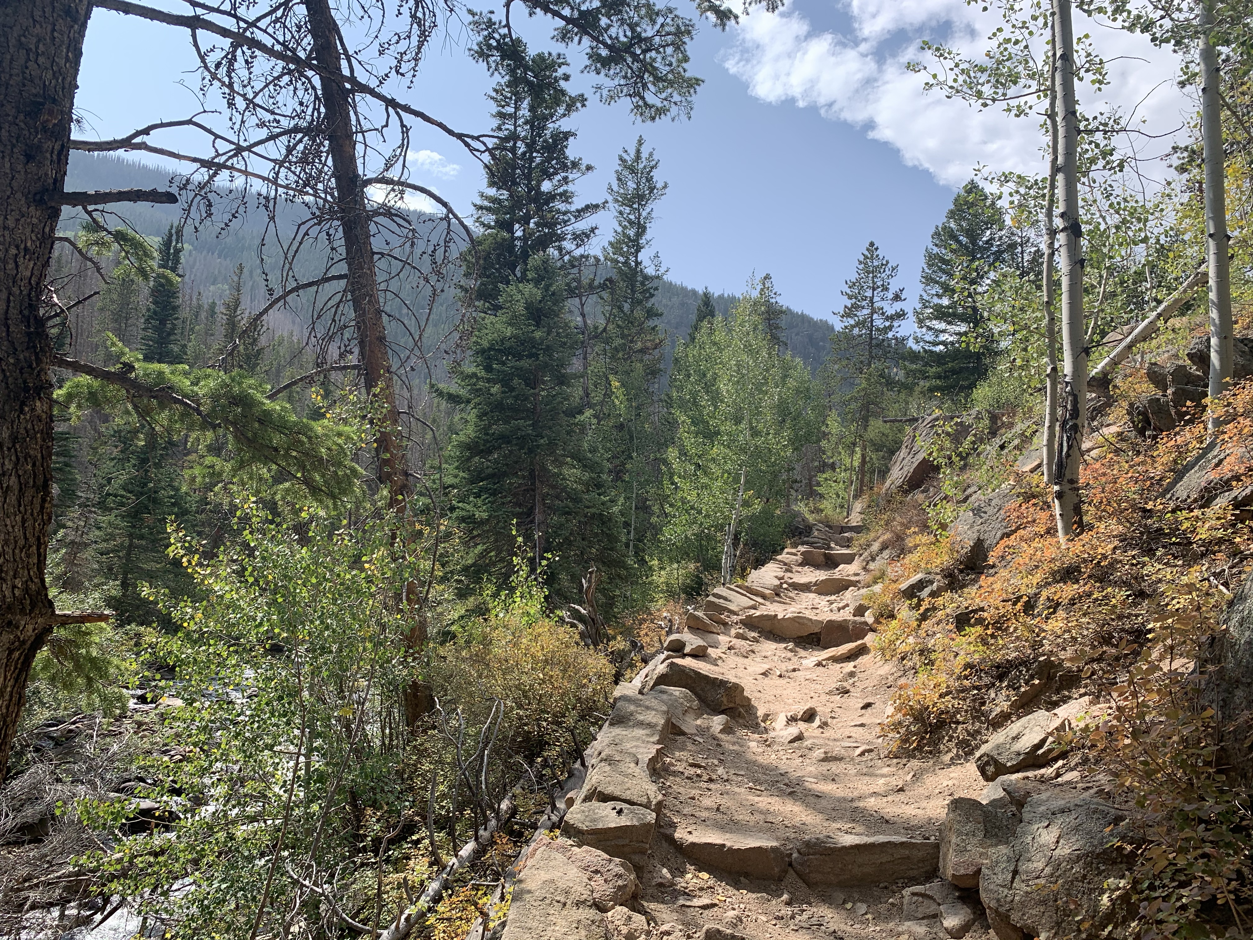
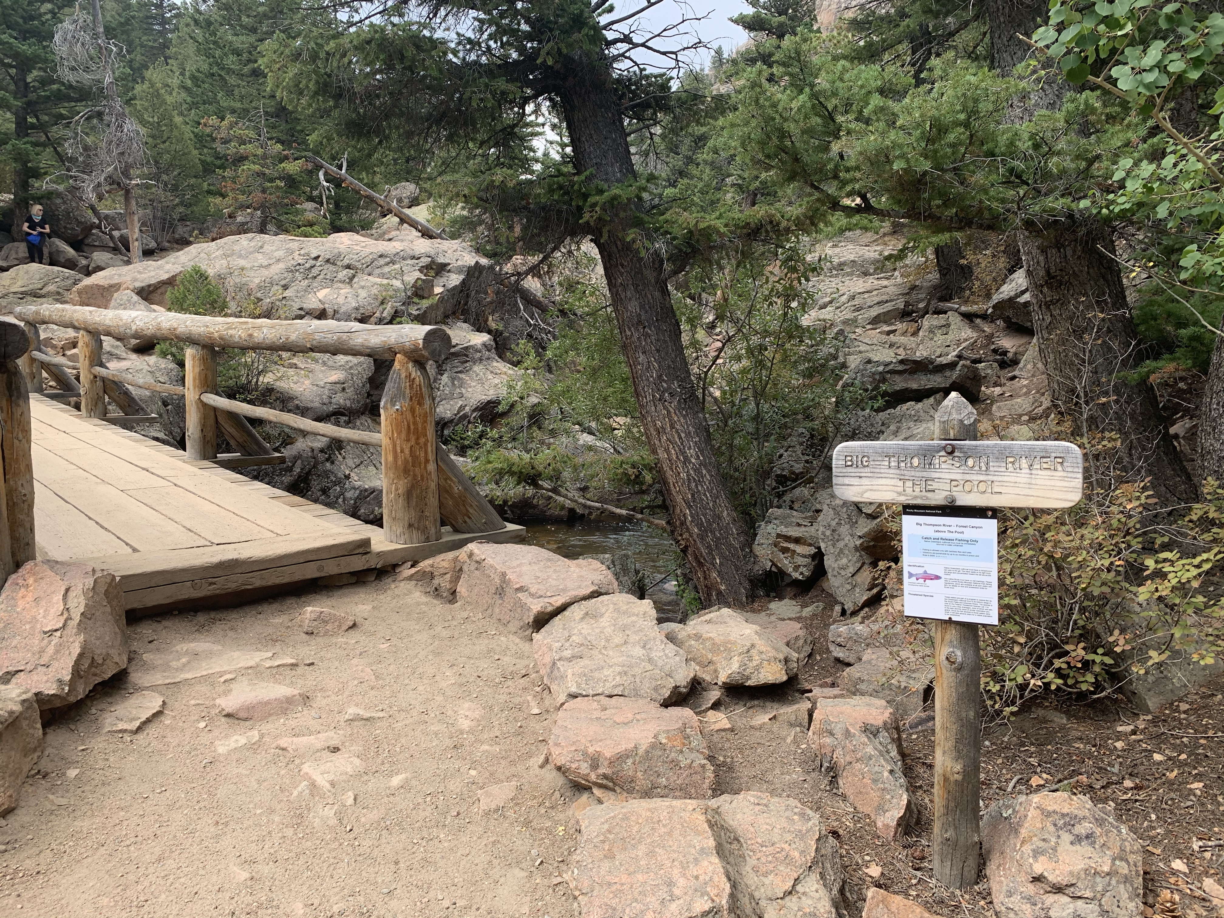
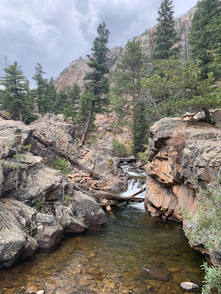
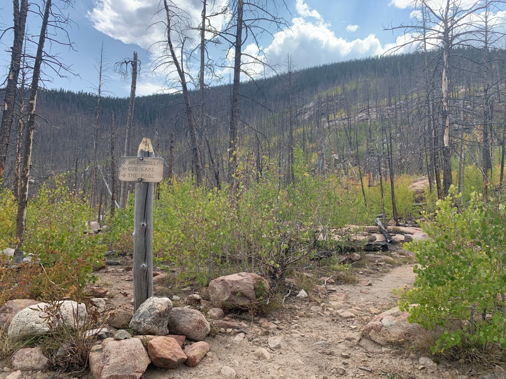
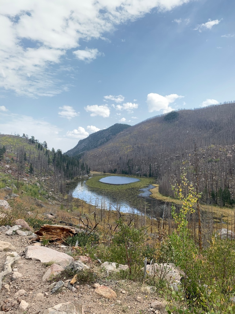
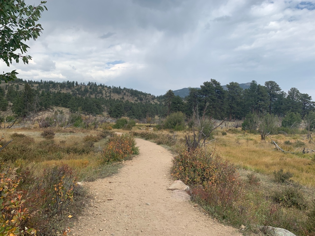
We parked at the summer trailhead for Fern Lake and hiked along Fern Lake trail for 1.7 miles until we reached the Big Pool junction. This section of the trail is mostly flat and follows the river, with many points of river entry. Once at Big Pool, we followed the trail left towards cub lake— about 1.2 miles from the junction. This section of the trail contains all the uphill, through the burned part of the canyon. Once to the top, you pass a trail junction that leads to Mill Basin (and Lake Bierstadt). Continue left to Cub Lake. We paused at Cub Lake for some photos, then continued in the trail 2.3 miles downhill back to the Cub Lake Trailhead. From there, we followed the dirt roadway back to the Fern Lake summer trailhead (about 1 mile). Great fall hike!

Big Pool. (1.7 miles)
Left for Cub Lake
Uphill section through fire damage
Left for cub lake
Cub Lake
Cub Lake
Cub Lake

371.6 miles: Friendship Trail, Ouachita National Forest, Jessieville, Arkansas

Date: September 11, 2020

Miles: 1 mile

Elevation Gain: 62 feet

Difficulty: Easy

Time: 30 min total

Trail Head:

https://www.alltrails.com/trail/us/arkansas/friendship-loop-trail

Another great family hike that will be perfect when the leaves start to turn colors! The Ouachita National Forest is pretty expansive— this trail is off of the Jessieville Ranger Station Trailhead. While the ranger station is currently closed due to COVID-19, you can still park at the trailhead and hike. This quick loop is paved and ADA accessible, following a wide path through the forest towards Frog Pond. Frog Pond has some picnic tables and a nice pavilion to sit under or plan a lunch. We had the trail to ourselves!

Notes:

370.6 miles: Cedar Creek Trail, Hot Springs Village, Arkansas

Date: September 6, 2020

Miles: 1.5 miles

Elevation Gain: 95 feet

Difficulty: Easy

Time: 40 min total

Notes:

We went to visit our parents in Arkansas a few weeks ago and made it out for a few quick local hikes! Cedar Creek Trail is located in Hot Springs Village, private property unless you are a resident. This trail had limited parking and was moderately busy the day we went. This trail will be perfect in a few weeks when the leaves start really changing colors— there was so much variety in the trees!

The trail begins by descending through forest towards the creek bed. The trail had lots of plaques describing the different types of trees. Once to the junction, we followed the trail loop to the left and then looped back to the main trail. Great quick hike!

369.1 miles: Notch Trail, Badlands National Park (North Unit), Interior, SD

Date: Sunday, August 29, 2020

Miles: 1.3 miles

Elevation Gain: 128 feet

Difficulty: Moderate to Difficult (due to terrain)

Time: 45 min total

Trail Head:

https://www.alltrails.com/trail/us/south-dakota/notch-trail

Notes:

Notch Trail is off the main major trailhead, along with the Door and the Window trails. This trail head was the most crowded area of the park we visited, due to the short distance of each trail. Parking is limited and sure to fill up, with the Notch Trail beginning at the very right corner of the parking lot. The terrain is really not suitable for children (despite many parents trying)— steep cliff drop offs, a ladder climb, lots of loose rocks, etc.

The first quarter mile of the trail is flat and winds through rock formations to the base of the ladder. The rope ladder gains about 100 feet, but does require careful footing. This caused a little bit of a back up on the trail. There were also several parents who tried to take their kid on it, only for the kid to freak out half way up the ladder. Once we climbed the ladder, the trail narrows against the rock face and has steep drop offs with no chains or rails. The trail requires a few short sections of scrambling, before it opens up to a plateau where you can walk to the look out. Great view of the valley below!

367.8 miles: Castle Trail and Medicine Root Trail Loop, Badlands National Park (North Unit), Interior, SD

Date: Saturday, August 29, 2020

Miles: 8.3 miles

Elevation Gain: 262 feet

Difficulty: Easy to Moderate

Time: 3 hr total

Trail Head:

https://www.alltrails.com/trail/us/south-dakota/castle-trail

Notes:

Saturday morning, we woke up before sunrise and drove through the park as the first light hit. We saw so much wildlife— buffalo, big horn sheep and ibex. We parked at the Fossils trailhead, and started at the Castle Trail, located across from the parking lot. This trail is accessible from two other trailheads as well; we chose to park at the trailhead we thought would be the least crowded. We started this hike at 7 am to beat the heat, since there is barely any shade on this route.

From the beginning on the trail, we hiked through mineral beds and cracked dirt for the first quarter mile. This section of the route is harder to find, but has red poles to mark its location. Once to the prairie grasses, the trail is easy to spot and winds by several rock formations. At two miles, you reach the trail junction with Medicine Root and Saddle Pass trails. We took a brief detour to the view from Saddle Pass, before deciding to complete the lollipop loop clockwise following Medicine Root Trail.

Medicine Root Trail treks away from the rock formations into the prairie lands of the Badlands. There was almost no shade for the next two miles. At a little over four miles, we reached the second trail junction (off Old NE Rod), back to Castle Trail. The remainder of the lollipop loop curves through some of the rock formations with some really cool views of rock layers. We saw some big horn sheep here. For the entire 8+ miles, we o let passed a few other hikers— great trail to avoid crowds and see most of the park!