437 miles: Plymouth Mountain via Plymouth Creek & Meadowlark Trails, Deer Creek Canyon Park, Littleton, CO

Date: November 1, 2020

Miles: 6.2 miles

Elevation Gain: 1453 feet

Difficulty: Moderate

Time: 2 hr 30 min total
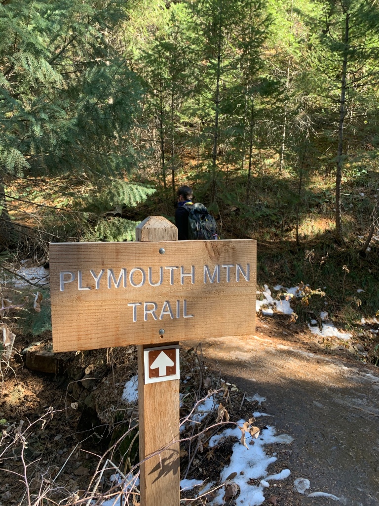
Trail Head:

https://www.alltrails.com/trail/us/colorado/meadowlark-trail-to-plymouth-mountain

Notes:

I can’t believe this was my first time hiking at Deer Creek Canyon Park! This is a really scenic open space south of red rocks, with a few different trail systems. We started this hike from Plymouth Creek Trail, which is a hiker only route. From Plymouth Creek, the trail gradually gains elevation— this section has little shade and features views of the foothills and red rocks. Once at the trail junction, we followed Meadowlark Trail to the right— this section gets wider and steeper (also it becomes multi-use). From here, we made the mistake of taking the first Plymouth Mountain trail on the left— instead, you want to continue to the second junction. Or, take the scenic route like we did! At the second junction, the trail becomes steep until the scenic look out. On the way down, we followed Meadowlark Trail to the parking lot for a change of pace. This trail was a steeper decline, but shorter. Great hike!

430.8 miles: Castle, Meadow and Parmalee Gulch Trail Loop (Walker Home Ruins), Mount Falcon Park, Indian Hills, CO

Date: October 31, 2020

Miles: 3.9 miles

Elevation Gain: 610 feet

Difficulty: Easy to Moderate

Time: 1 hr 20 min total

Trail Head:

https://www.alltrails.com/trail/us/colorado/

Notes:

I fell a little behind posting these! For Halloween we decided to go on an evening / sunset hike at Jeff Co Open Space Mount Falcon Park. We parked at the west trailhead and completed this easy loop which featured ruins from the Walker Home.

The trailhead has limited parking— we parked at the satellite lot and started the loop from Parmalee Gulch Trail. This trail first descends into the gulch, then gently climbs back up with views of the canyon. Once we hit the trail junction, we followed Meadow Trail to the Walker Home Ruins. The ruins were pretty cool. From there, we followed Castle trail to the right, back to the junction with Parmalee Gulch. Great local hike!

426.9 miles: South Table Mountain Trail, Golden, CO

Date: October 20, 2020

Miles: 1.6 miles

Elevation Gain: 479 feet

Difficulty: Easy to Moderate

Time: 1 hr total

Trail Head:

https://www.alltrails.com/trail/us/colorado/south-table-mountain-trail–2

Notes:

The days are starting to get shorter and shorter, so I’m trying to get in as many after work hikes as possible before day light savings time. I met up with a friend in Golden this week to hike South Table Mountain— one of the first hikes I ever did in Colorado! This is a short but steep trail, with great views of the foothills, front range and city.

The parking lot is in a residential neighborhood (street parking) and snakes up the side of table mountain. The trail is narrow and rocky, but easy to find and winds through the willows. Once at the top, there was plenty of space to socially distance and watch the sunset— great quick weekday hike!

385.9 miles: Enchanted Forest and Apex Loop, Apex Open Space Park, Golden, CO

Date: September 23, 2020

Miles: 3 miles

Elevation Gain: 676 feet

Difficulty: Easy to Moderate

Time: 1 hr 30 min total

Trail Head:

https://www.alltrails.com/trail/us/colorado/apex-enchanted-forest-trail-loop

Notes:

It’s been awhile since I went for a weekday hike after work! It was nice to get out mid week and stretch my legs for an easy local hike. I met up with a friend at Apex Open Space for a social distance hike— the trailhead is along Lookout Mountain Road and does not have a formal parking lot at this trailhead. However, there was plenty of parking on the side of the road near the trailhead.

Although this trail was in a neighborhood, it feels more secluded since it’s in the canyon. The trail starts by descending curvy switchbacks (definitely built with a biker in mind) to the trail loop junction. We chose to first go right and follow the Enchanted Forest Trail. This trail continues to descend to the base of the canyon, through trees and over streams. About 1.7 miles in, we came to the next trail junction, where we followed Rocker trail to Apex trail. Once at Apex, we made a left to finish the short loop and ascend back up the canyon. There were a lot of bikers! We also heard elk bugling.

248.3 miles: Panorama Point to Bear Creek Trail Loop, Corwina Park, Evergreen, CO

Date: Wednesday, June 24, 2020

Miles: 2.9 miles

Elevation Gain: 633 feet

Difficulty: Easy to Moderate

Time: 1 hr total

Trail Head:

https://www.alltrails.com/trail/us/colorado/panorama-point-to-bear-creek-trail-loop

Notes:

I’m trying to get out for hikes more during the weekdays, after work in the evenings. Despite its’ close proximity, I’ve never hiked at Corwina Park before. For date night we did a quick hike before the rain came into the front range. Corwina Park is free, but the trailhead we were at had limited parking (enough for maybe 10 cars). At 5 PM, we snagged the last spot.

From the parking lot, there is one trail, Bear Creek. We took this narrow spur uphill for .8 miles to reach the junction with the panorama point trail loop. From the junction, we continued straight to complete the loop counter-clockwise. This method makes the hike a little steeper, so for a more gradual incline I would recommend going clockwise. This trail has definitely seen heavy use— lots of sections had significant erosion. The top featured some nice look outs of the surround mountains in Evergreen.